| Aka: | Tracon II |
| Console: | PC |
| TV Standard: | Other |
| Release Date: | 1990-01-01 |
| Players: | 1 |
| Co-op: | No |
| ESRB: | E - Everyone |
| Type: | Flight Simulator |
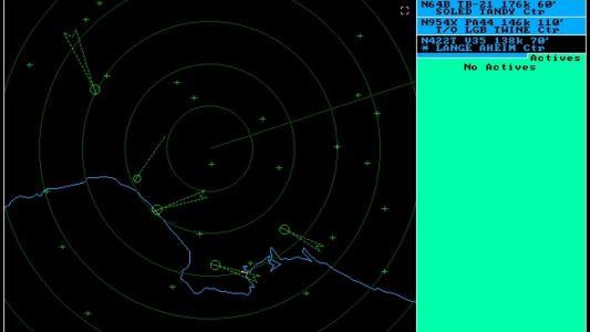
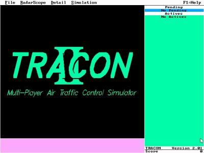
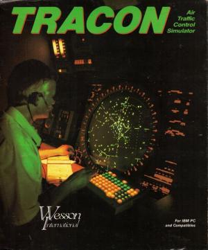
TRACON is a series of game software programs that simulate an air traffic control environment on a personal computer. The games were originally sold by Texas-based Wesson International as an offshoot to their line of professional air traffic control simulation products. TRACON and RAPCON were released in 1989, and TRACON II was released in 1990. Wesson was merged into Adacel in 2001.
Over its life, the software has evolved from a DOS to a Microsoft Windows environment. It included graphics that simulate a TRACON air traffic controller's situation. At periodic screen updates, aircraft icons move slowly across the controller's sector. The player sees an aircraft icon with its identifier (AA34) and the aircraft's altitude or flight level (110).
The game familiarizes a player with the difficulty of tracking many events simultaneously. Every aircraft is moving in a dynamic environment. The player must develop a feel for three-dimensional space represented in two dimensions on the screen. Generally, aircraft must be kept separated by 1,000 vertical feet and three miles horizontal separation. A series of alarms sound if adequate space between aircraft is not maintained. A few separation conflicts can quickly wipe out the player's entire accrued point value. The closer aircraft get, the more severe the warnings. A mid-air crash ends the game.
There are two ways to run ATC simulation scenarios : a) random ones created by the program itself, or b) your own ones which you may edit with a simple text editor (file extension *.sim), following all the syntax rules and geographical sector details .
In case (a) the player selects traffic density to control (aircraft / time) and one from the available geographical sectors and then the game issues random start and end points within this sector at random altitudes and activation times. It juggles aircraft types, some being commercial airline traffic while others are slow-moving general aviation aircraft. Each game sees a different mix of aircraft, callsigns, start- and end-points, unless the user elects to "repeat the last simulation." Aircraft types have profiles: an airliner might cruise at 250 knots while general aviation craft may cruise as slowly as 90 knots. The player can slow an airliner to 170 knots in order to space aircraft in an approach pattern. If the aircraft is ordered to fly below its minimum speed, the game says, "That's below my minimum." Aircraft identify as heavy where appropriate. Flight plans can either transit a sector or involve takeoffs and landings. Users receive point credit for successfully getting aircraft through their respective flight plans. Points are continually deducted for each command issued to a pilot and for time delays. Shorter flights mean higher point counts. Each turn or change in speed the player orders costs points.
Aircraft arriving at the edge of the player's TRACON will call. "AA34 with you at one one thousand," the status line will display this in text, voice of the calling pilot will play, and the icon will persistently flash. If ignored, the aircraft will circle and hold at the radio fix identified as the beginning-point in the player's sector.
In case (b) the player selects his own simulation (*.sim) file to run and the scenario unfolds exactly as described by the designer. In this case the possibilities to use TRACON II as a more realistic ATC simulator are many, adding to it the fact that a user may also design his entirely own airspace-sectors (file extension *.sec) to work with. Thus a large number of fans all over the world appeared offering sectors and simulation files well beyond the standard ones coming with this package. There are of course some limitations. The maximum altitude one may use is restricted by the maximum binary number (8bit) used in this program to below 31000 feet which, however, is enough for Terminal Area Control, although insufficient for higher airspaces. The aircraft performance can be varied but not with all necessary parameters, although still almost realistic for aircraft approaching - departing aerodromes at below 10000 feet. The sector creation needs careful design for its syntax but it is otherwise simple. The positioning on points demands a conversion of geographical coordinates to a X,Y grid centered on a point selected by the user which is allocated the 0,0 coordinates.
Plenty of explanations for the syntax and files details were provided with the initial version.


